
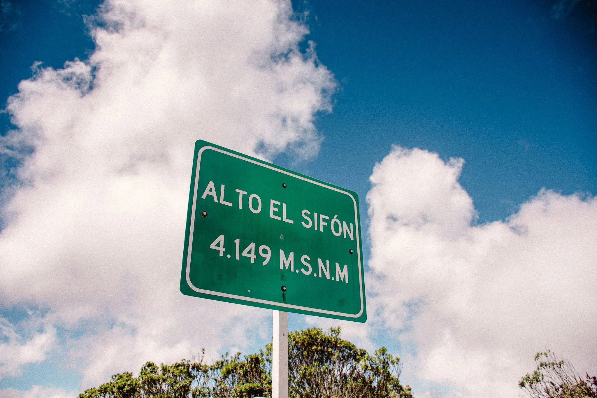
Road to El Sifón
One Road That Unveils Many Colombias
2 Stages | 3 Nights
$ 1600 US (double accom)
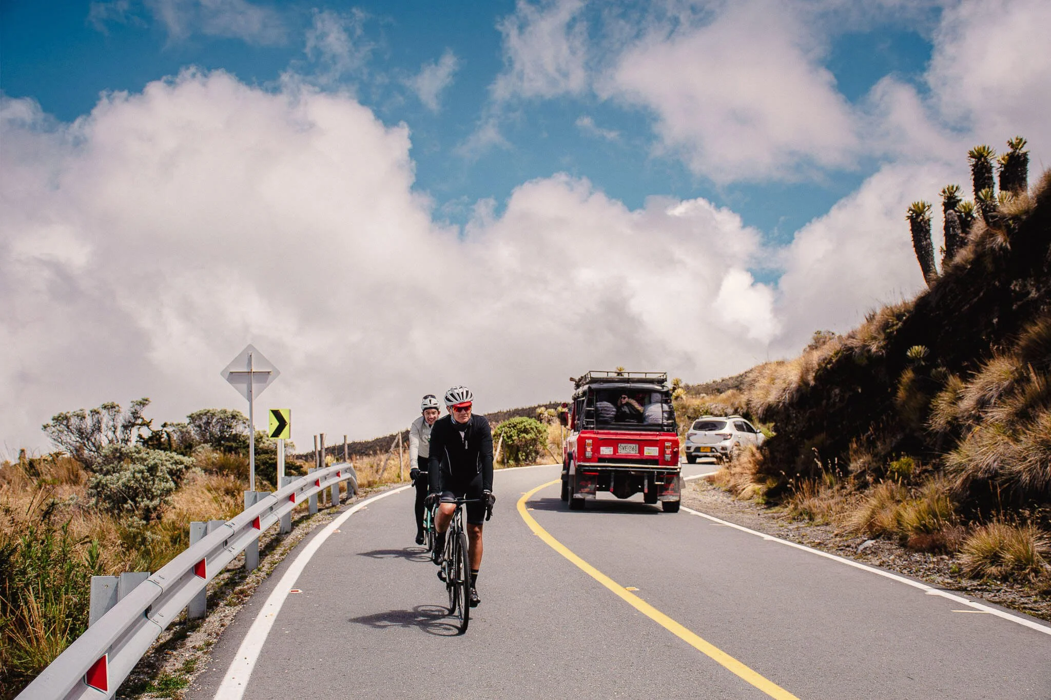
Ride from tropical valleys deep into the high páramo of the Colombian Andes
Ride from tropical valleys deep into the high páramo of the Colombian Andes
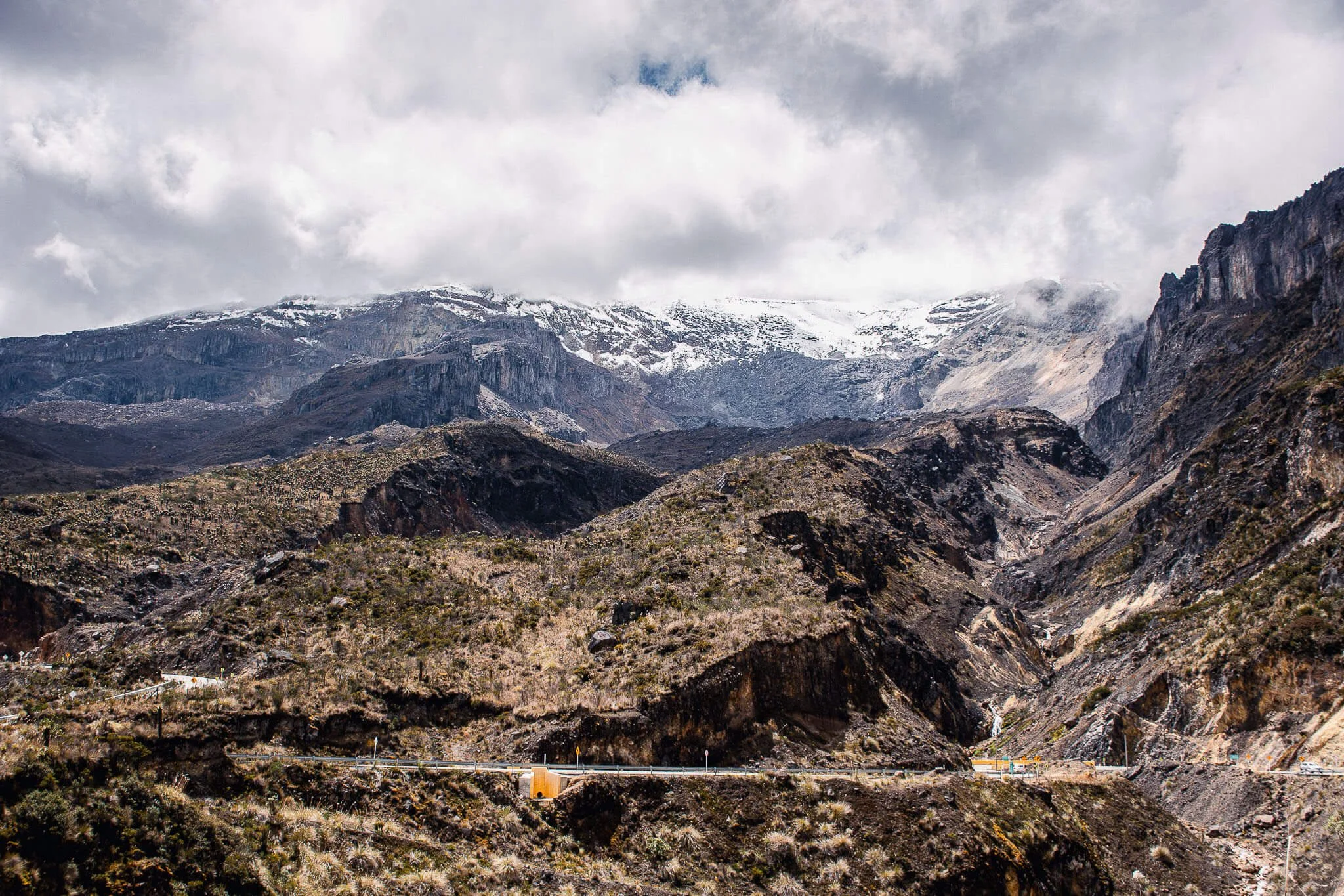
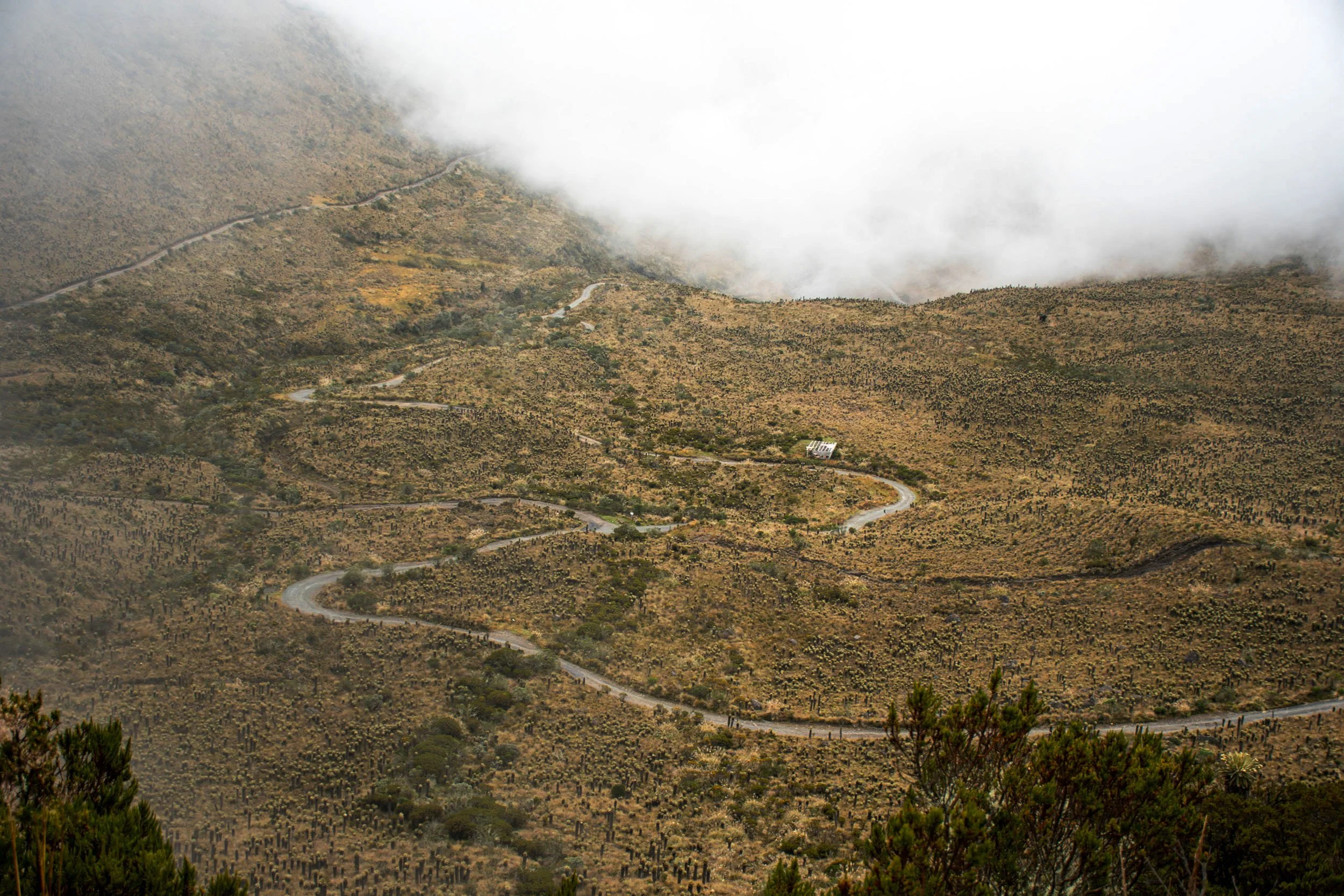
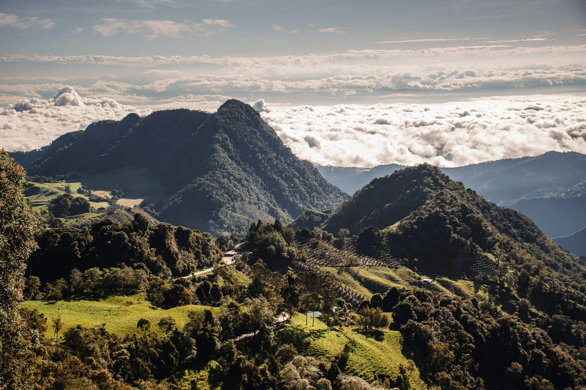
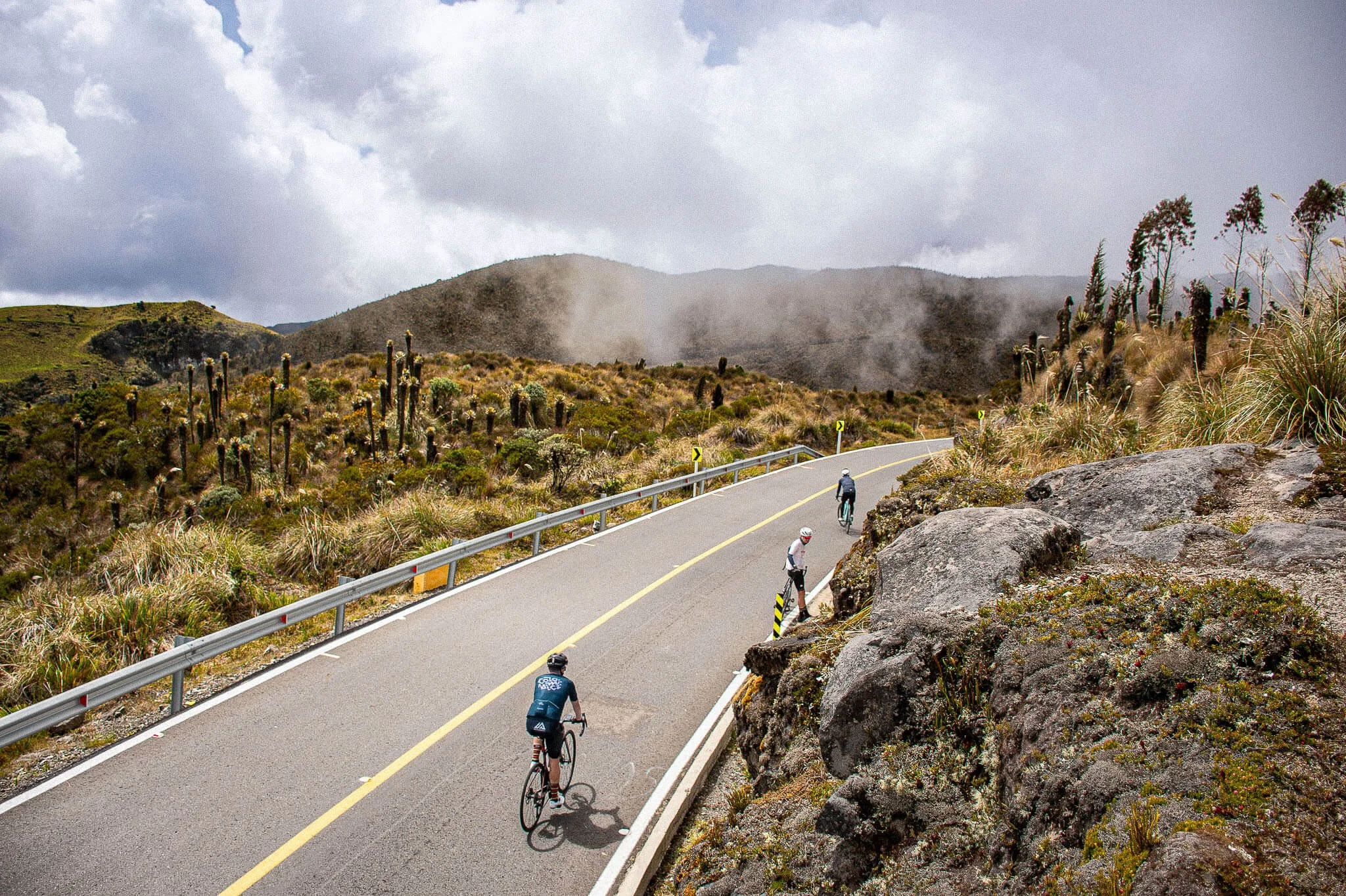
Experience Colombia’s most immersive climb. El Sifón connects the Magdalena Valley to the high Andes, revealing rare landscapes, small communities, and diverse cultures along a single road.
Officially, the longest climb ever used in a UCI race (Vuelta a Colombia 2024). An epic ride across 4 climate zones, reaching the high páramo above 4,150 m.


What to expect
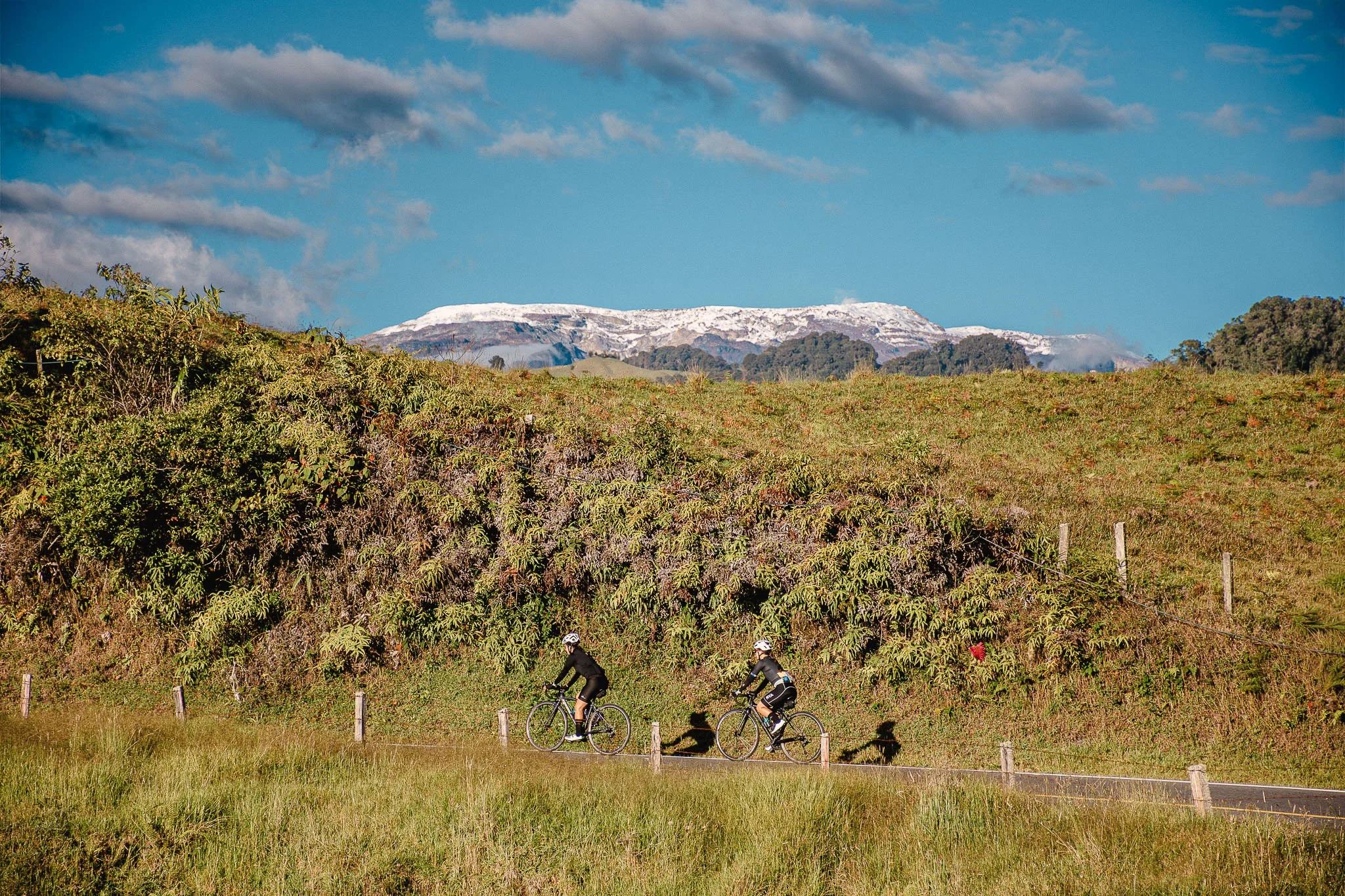
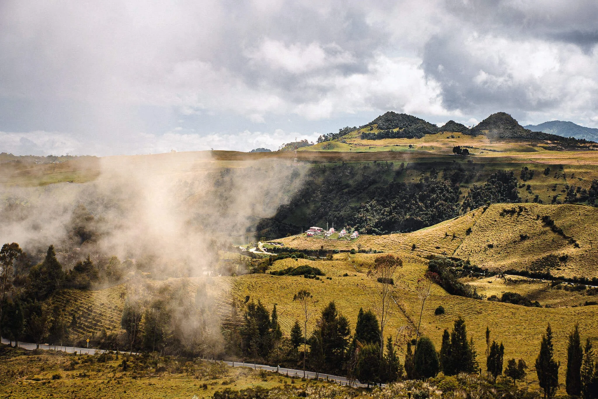
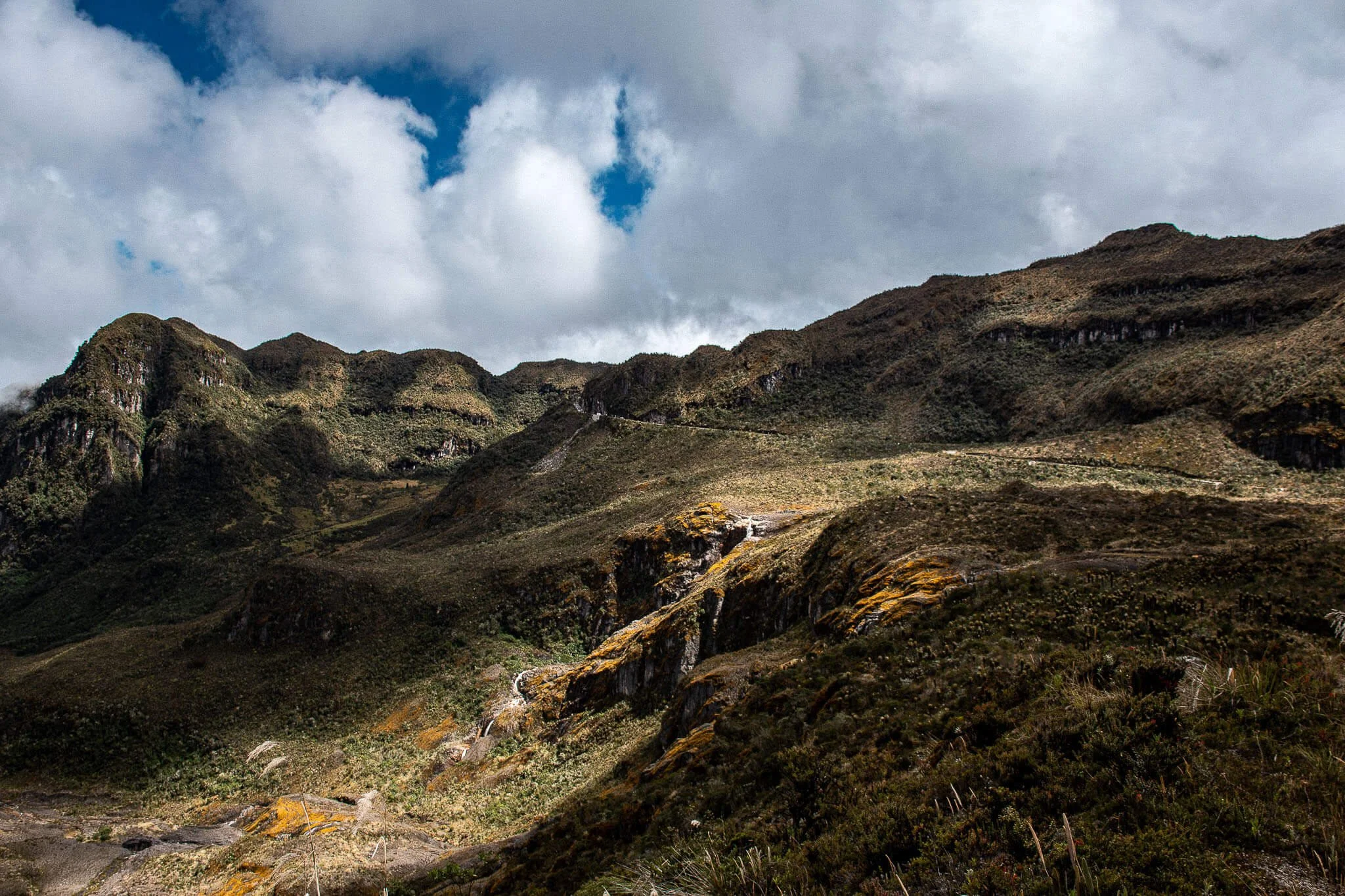
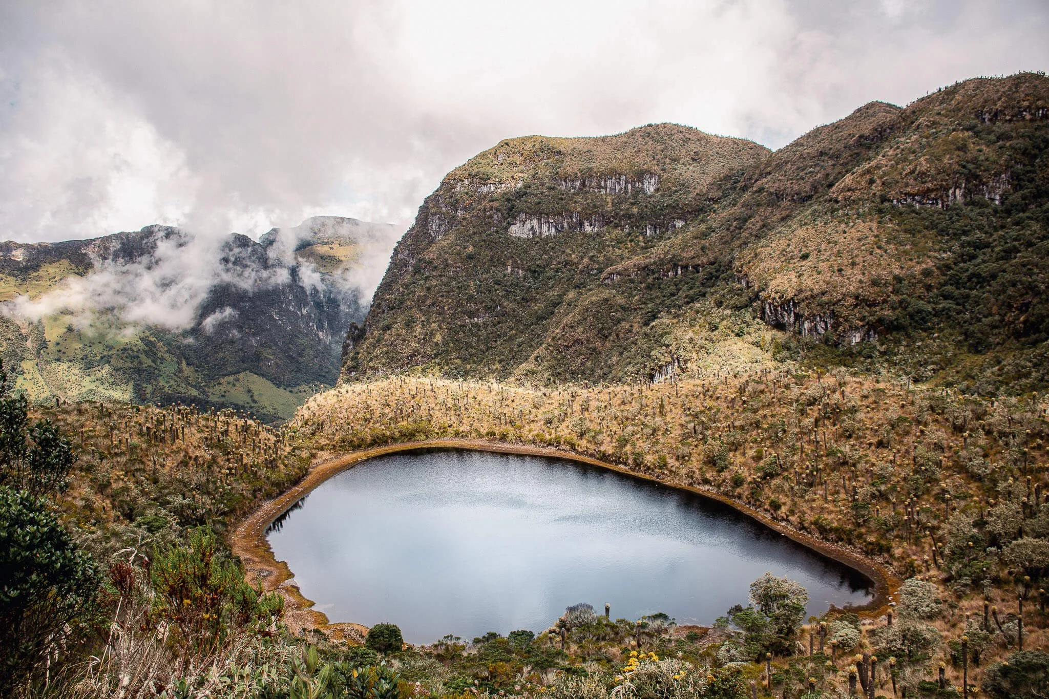
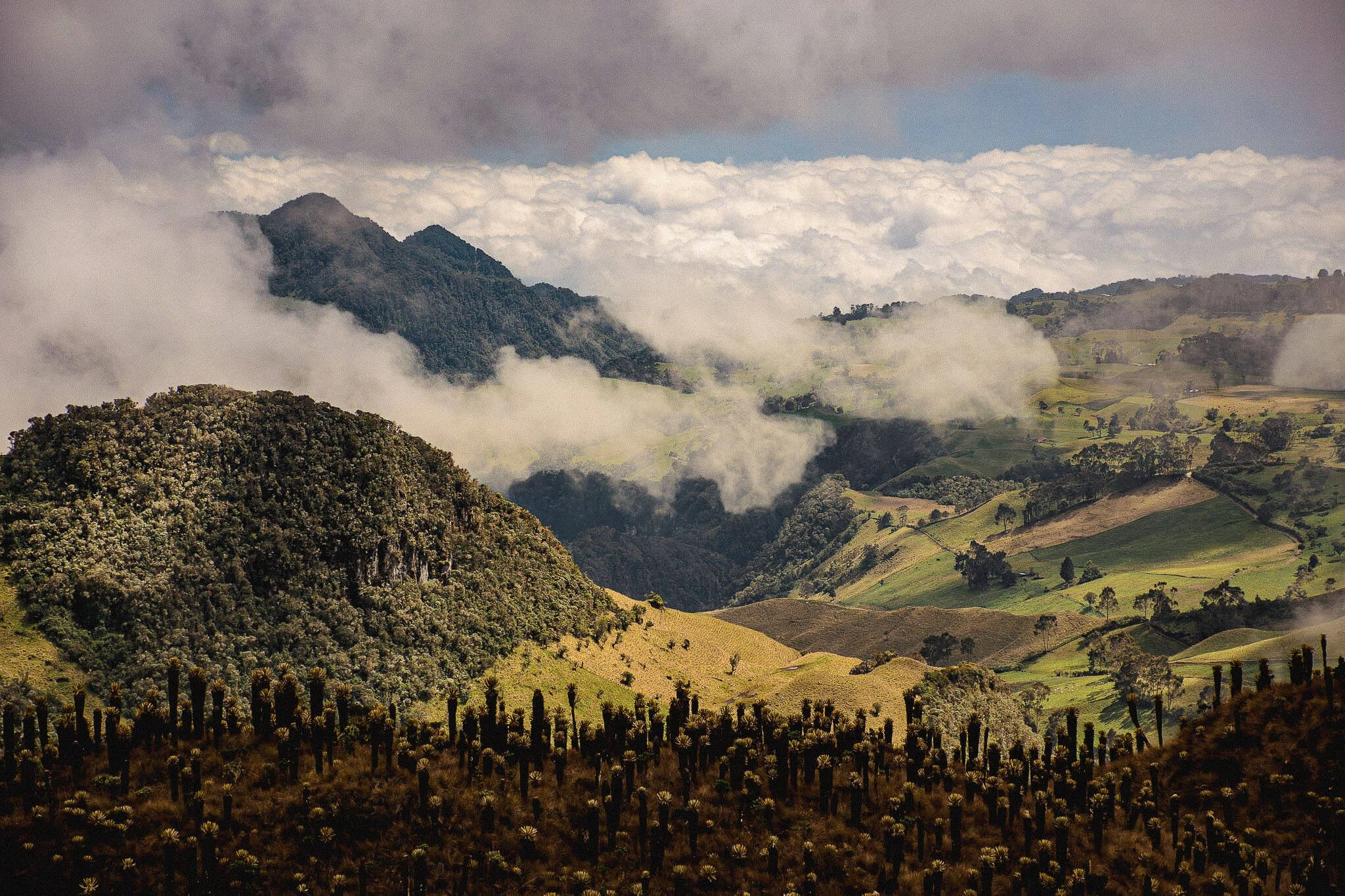
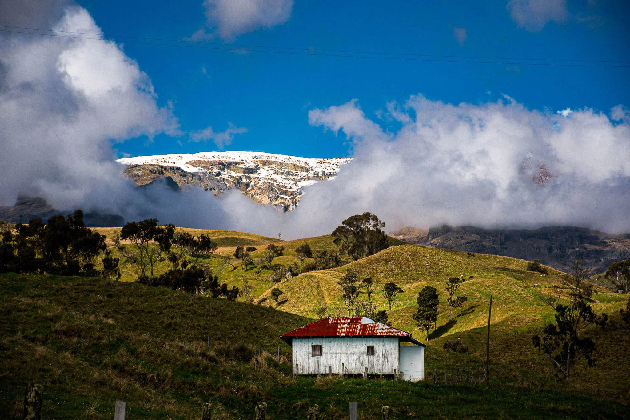
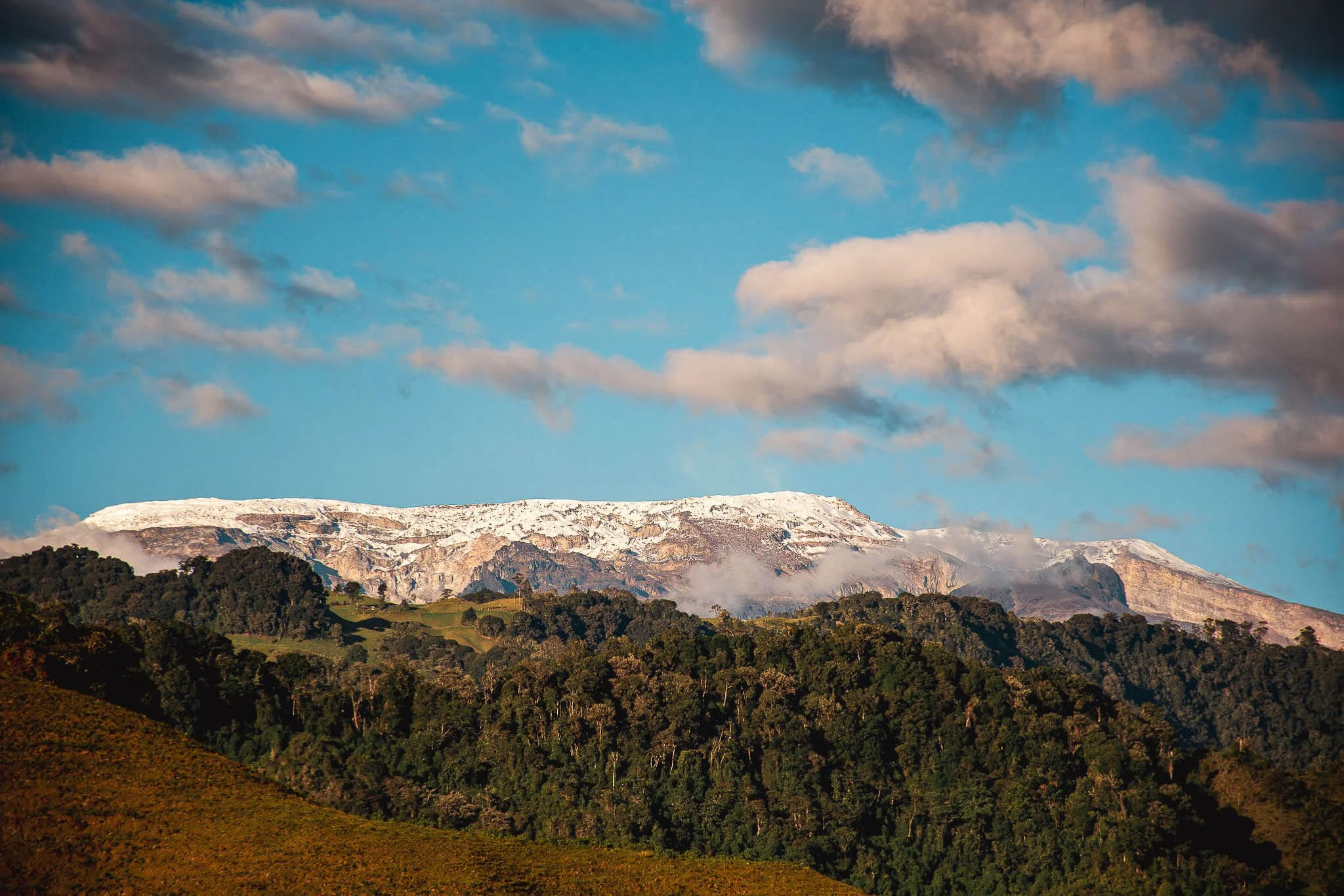
Expect an epic journey through the Colombian High Andes and its wild terrain. The route takes you from lush tropical valleys up into the high páramo, where the landscape transforms dramatically.
You’ll dissect Colombia’s four distinct climate zones in just two days — from humid jungle to cool coffee hills, alpine forest, and the surreal high páramo.
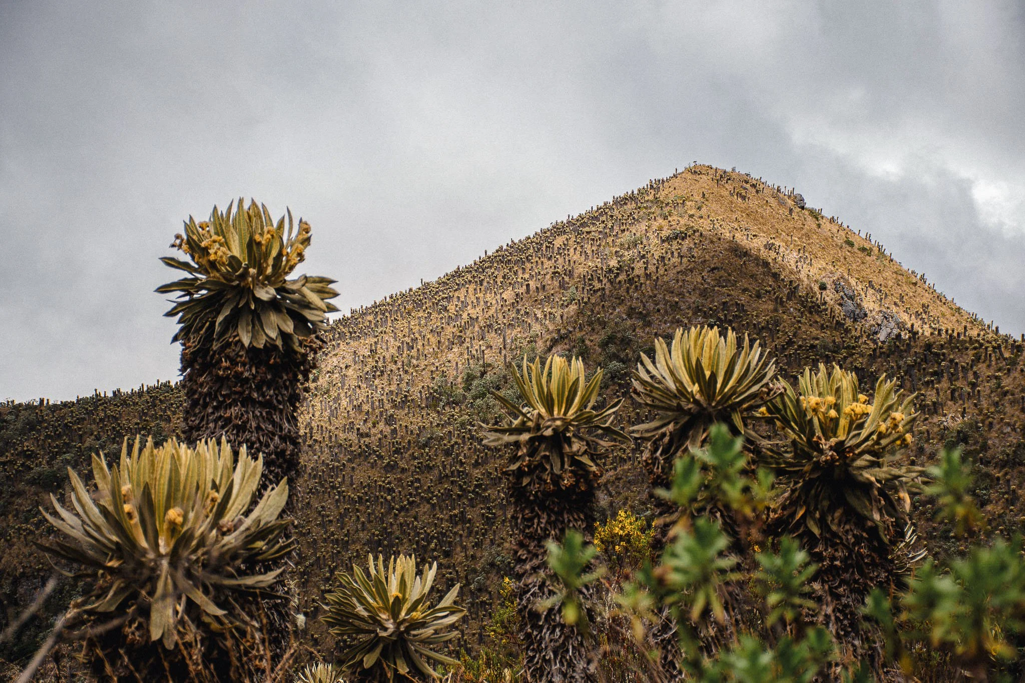
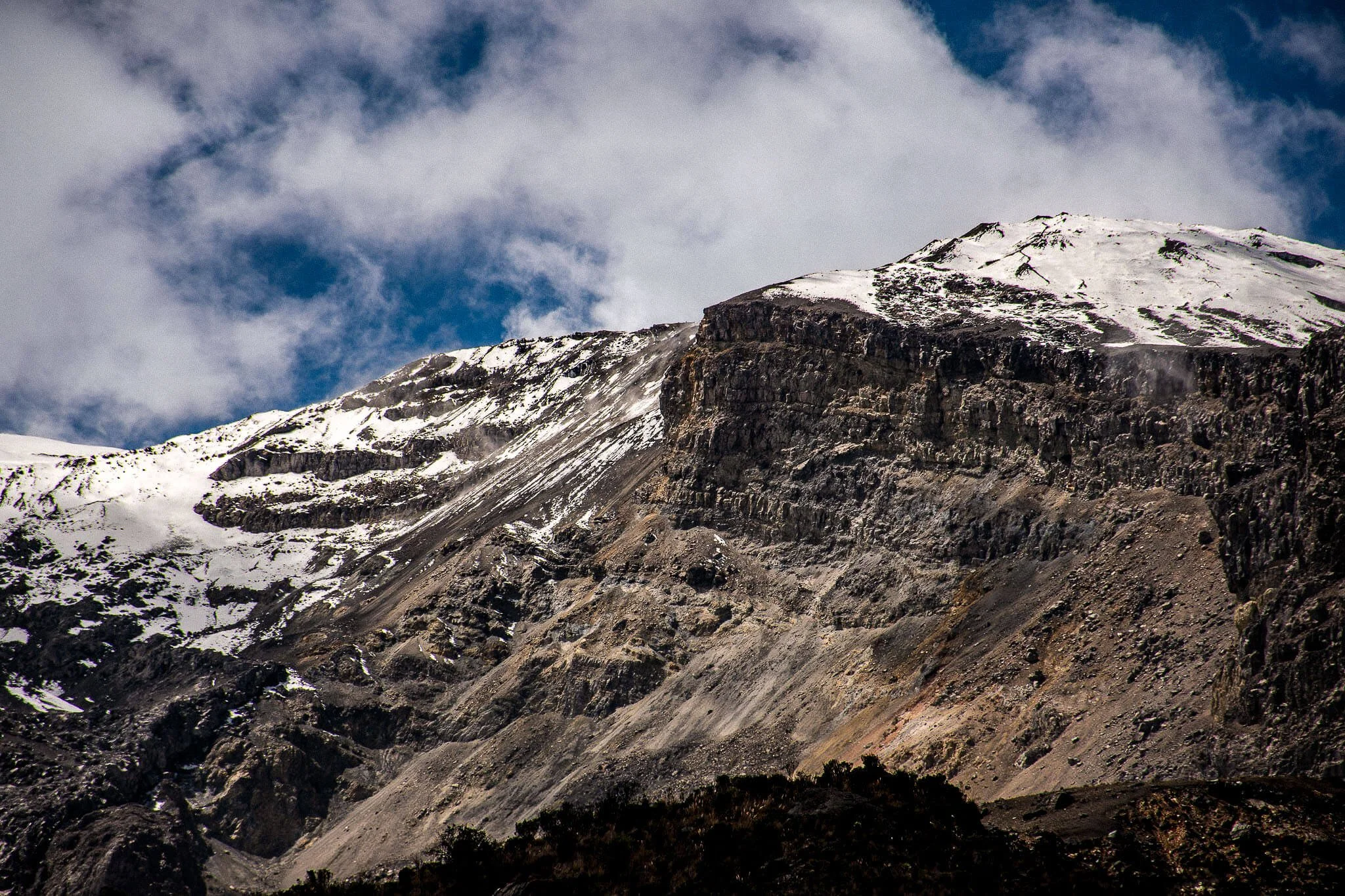
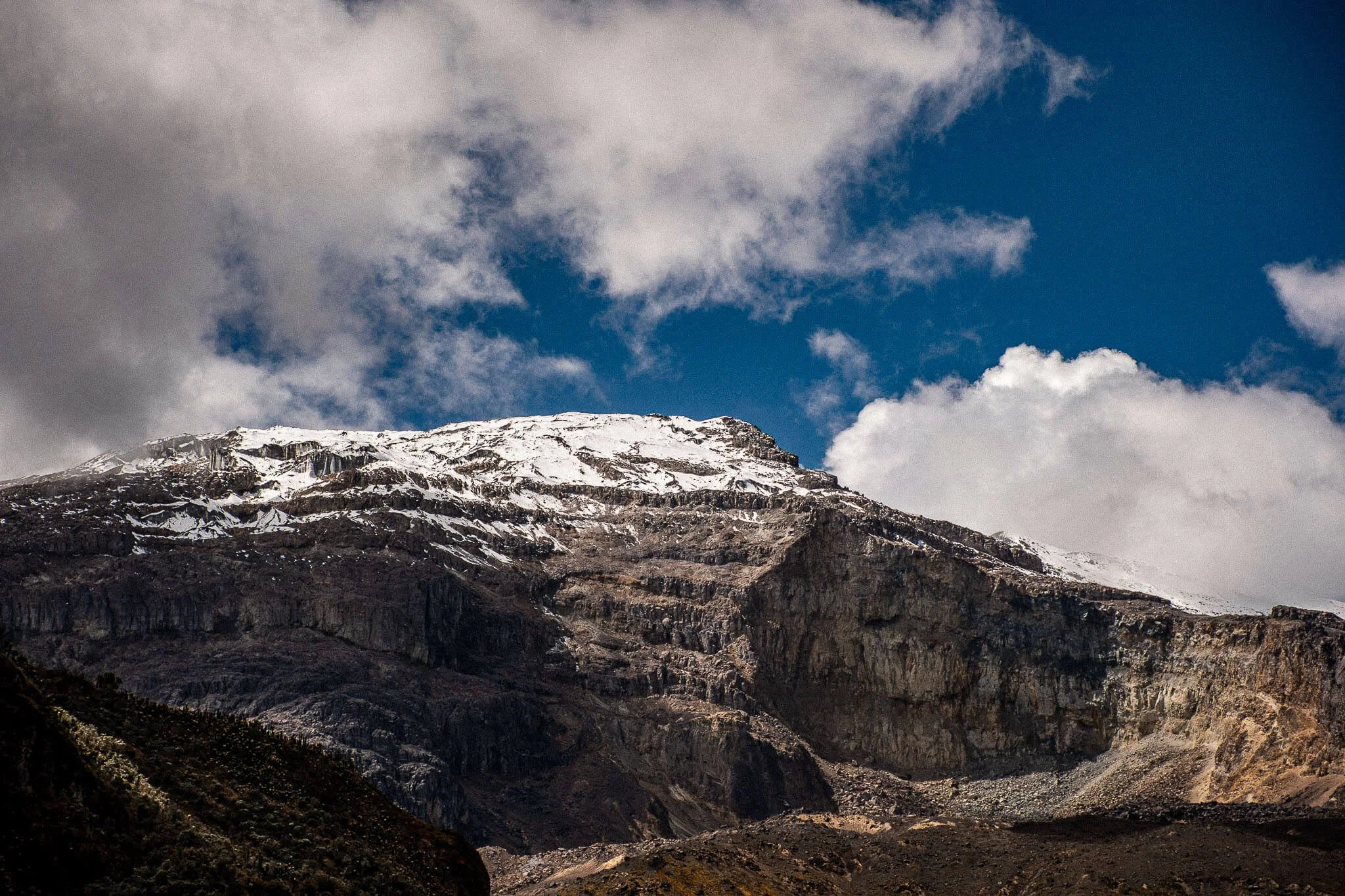
Along the way, you’ll ride past fields of frailejones towering above the misty slopes, with the snow-capped Nevado del Ruiz looming in the distance. It’s like riding on another planet — vast, remote, and breathtaking.
The Road to El Sifón: A road that unveils Colombia.
From the heat of the Magdalena Valley to the frozen páramo of Los Nevados.
One paved road. Four worlds. A country in motion.
How El Sifón stacks up against the world’s famous climbs.
How El Sifón stacks up against the world’s famous climbs.

What’s included:
✔︎ A support vehicle.
✔︎ Top-rated accommodations (3-star and above).
✔︎ Daily breakfasts.
✔︎ Nutrition & hydration. (gels, fruits, local snacks)
✔︎ Travel accident insurance.
✔︎ Professional photographer on the Queen stage.
What’s not included:
✘ Your flights.
✘ Alcoholic beverages.
✘ Lunches and dinners.
✘ Local accommodation tax.
✘ Your shopping!
Possible add-ons (additional costs):
+ Bike rental
+ Airport transfers
+ Single occupancy (instead of double)
At a Glance:
Duration:
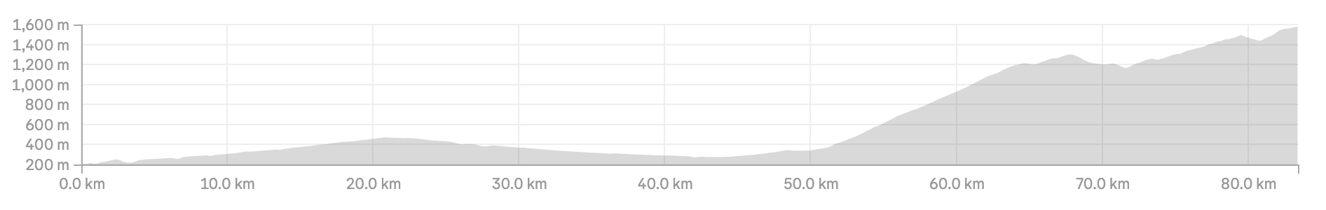
2 stages / 3 nightsTotal Distance:
166 km (103 mi)Total Elevation Gain:
5,150 m↑ (16,896 ft↑)Starting Point:
Bogotá (transfer to Honda)Ending Point:
ManizalesDifficulty:
ChallengingCultural Highlights: Nevado del Ruiz – a stratovolcano, Líbano – the gateway to coffee heartlands, and colorful Murillo.
Best Time to Ride:
All year round. (Dry winter: Dec-Feb)
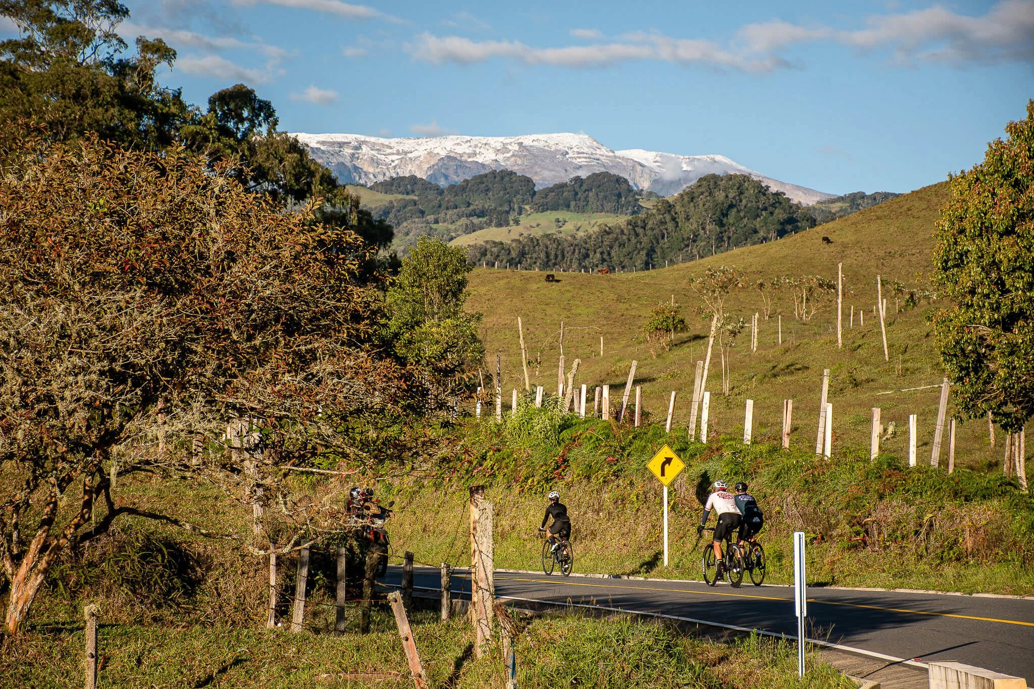
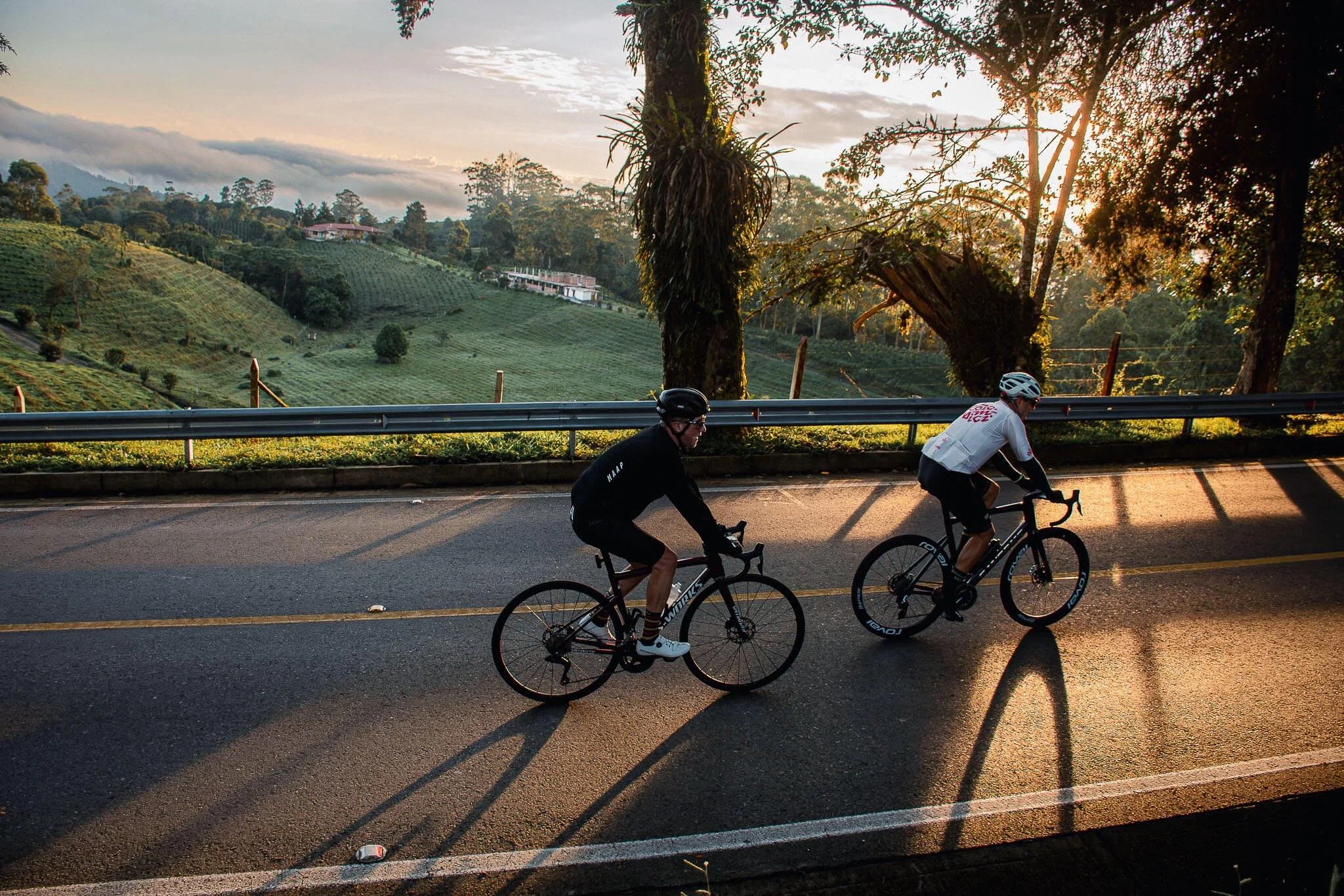
Stage 1:
Honda → Líbano
83 km (51 mi) | 1,850 m↑ (6,070 ft↑)
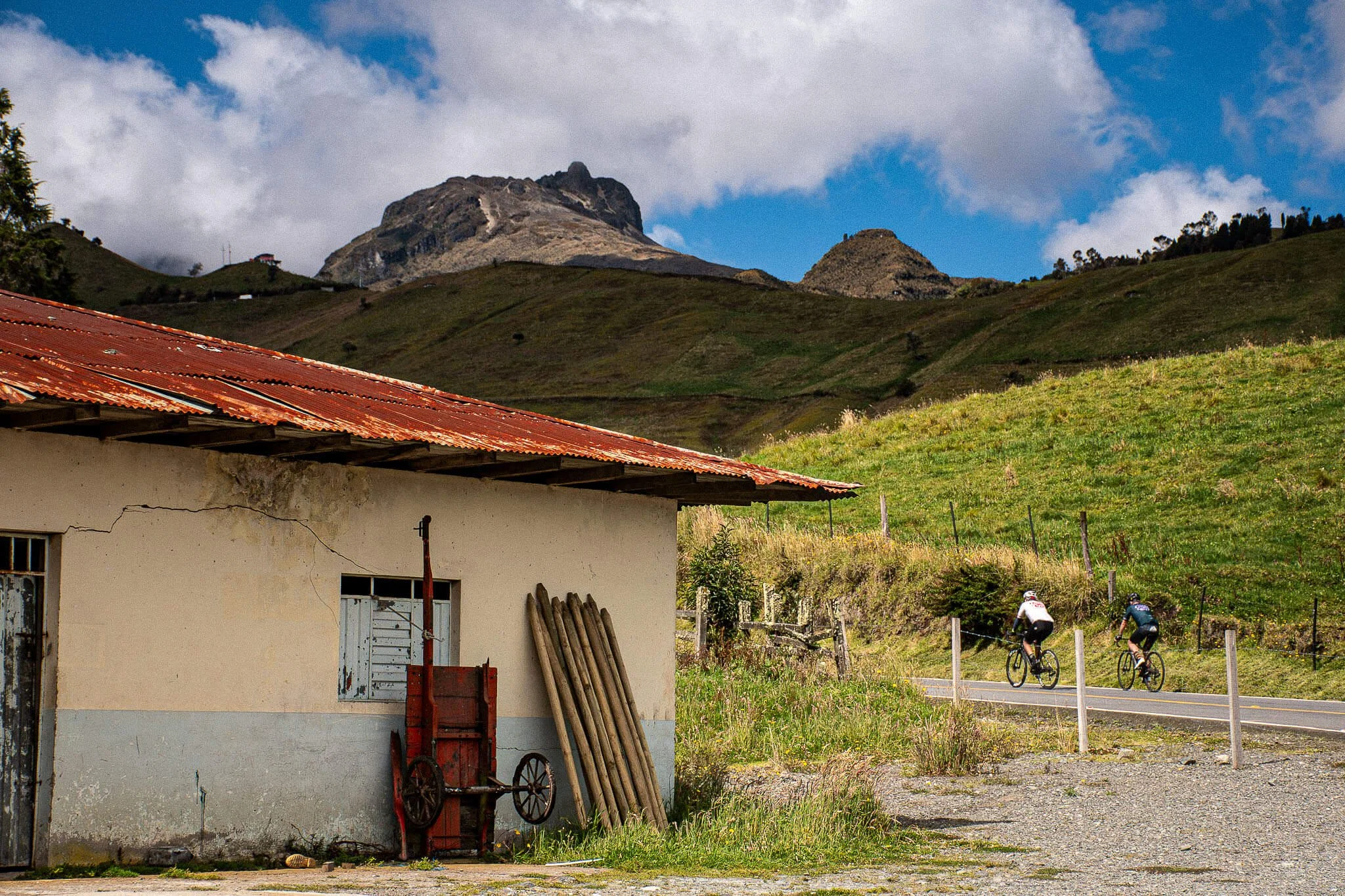
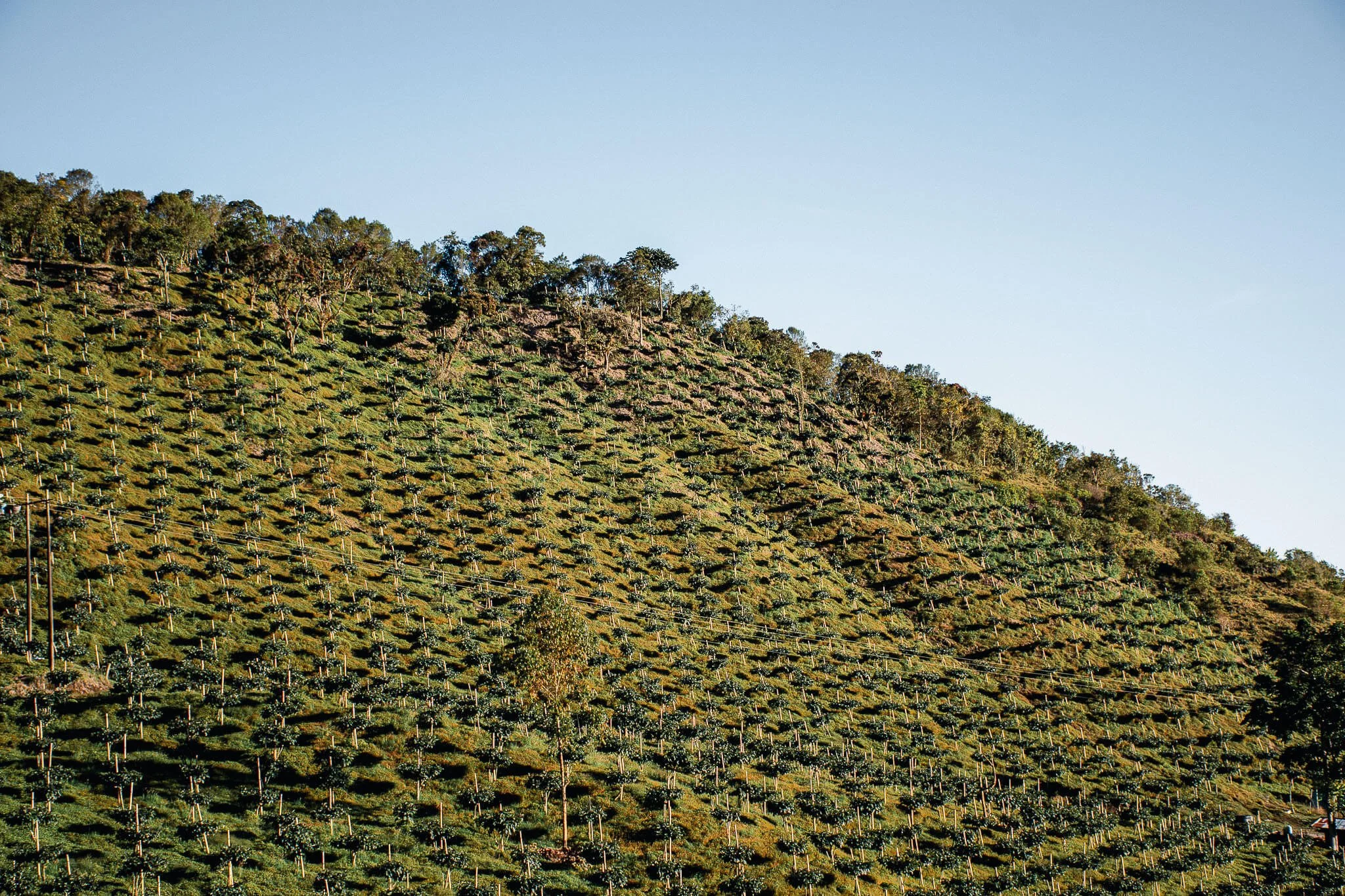
Ride through tropical lowlands lined with banana, lulo, and papaya trees before the road begins its slow, dramatic rise. You’ll pass the haunting ruins of Armero, where nature has reclaimed what was once a town.
As you climb higher, the air cools and the scenery shifts; lush jungle gives way to coffee plantations clinging to steep hillsides. You’ll feel the transition through Colombia’s climate zones, from hot and humid valleys to the fresh, fertile tierra templada of Líbano, a quiet coffee town surrounded by misty green mountains.

| Deep dive into Colombia’s Evolving Identity
| Deep dive into Colombia’s Evolving Identity

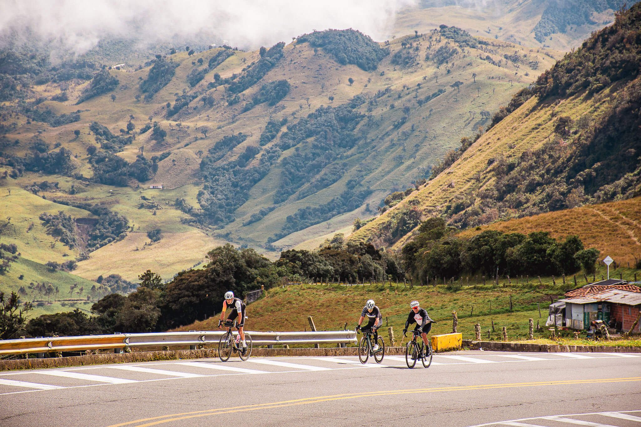
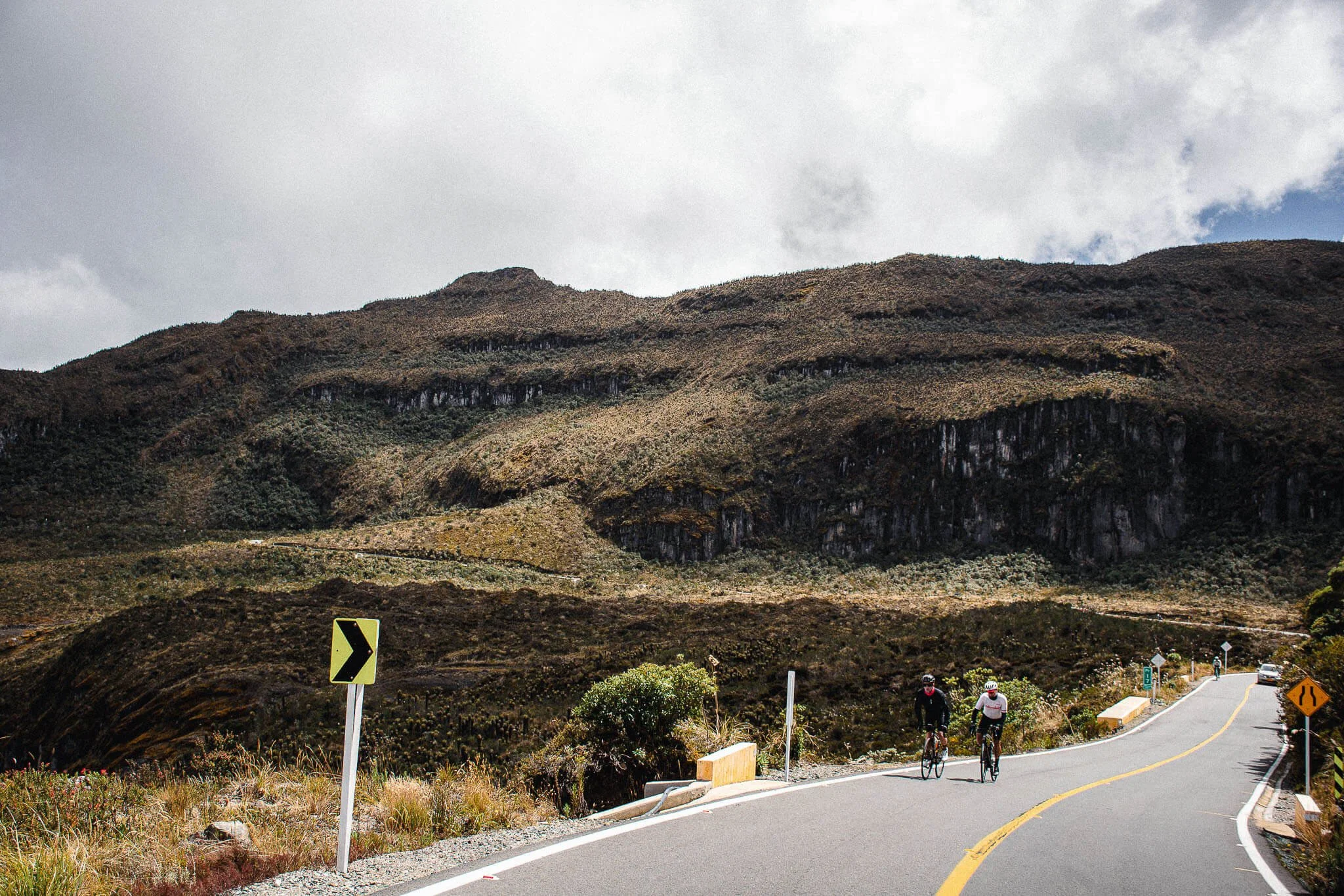
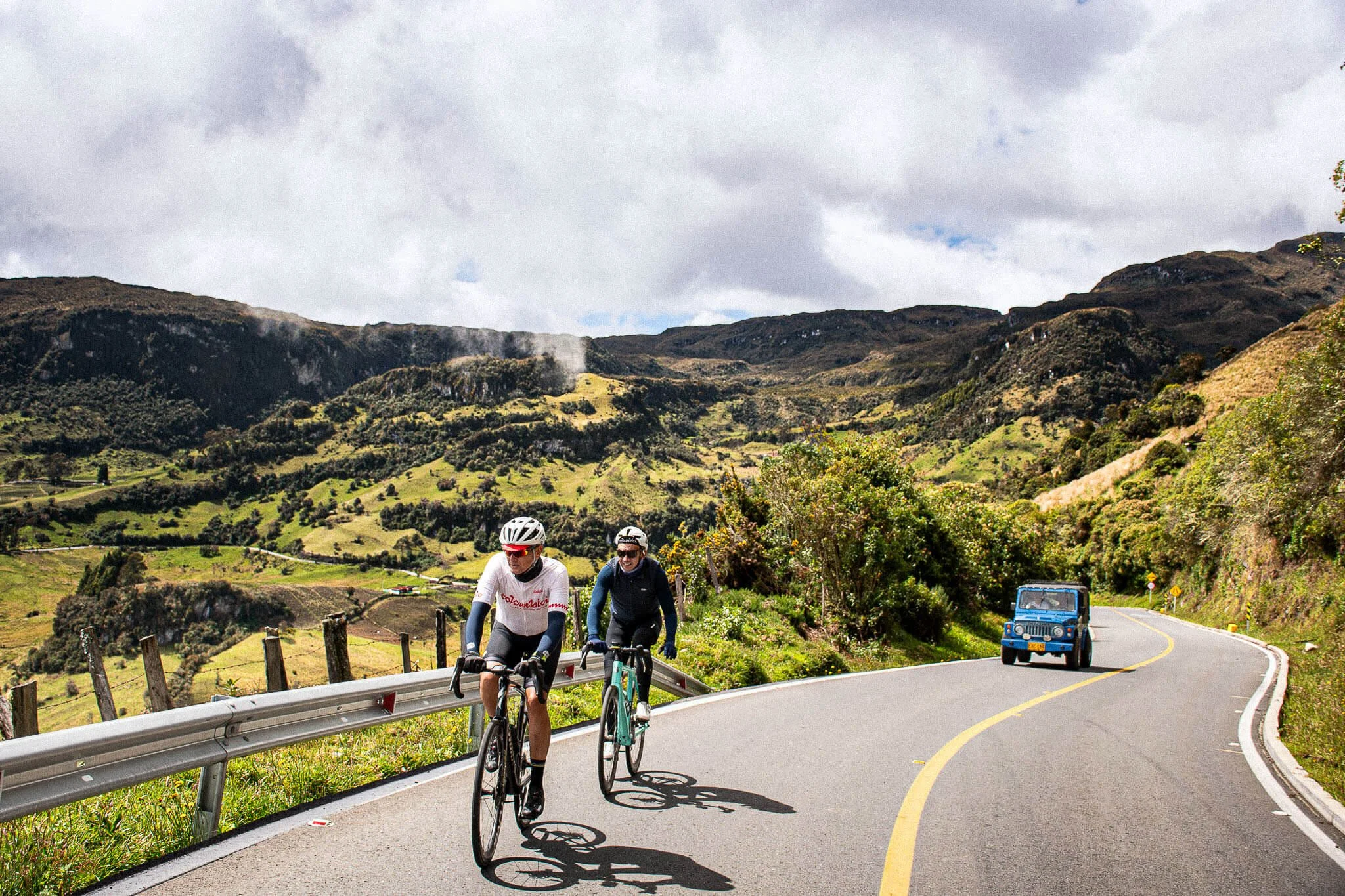
Stage 2:
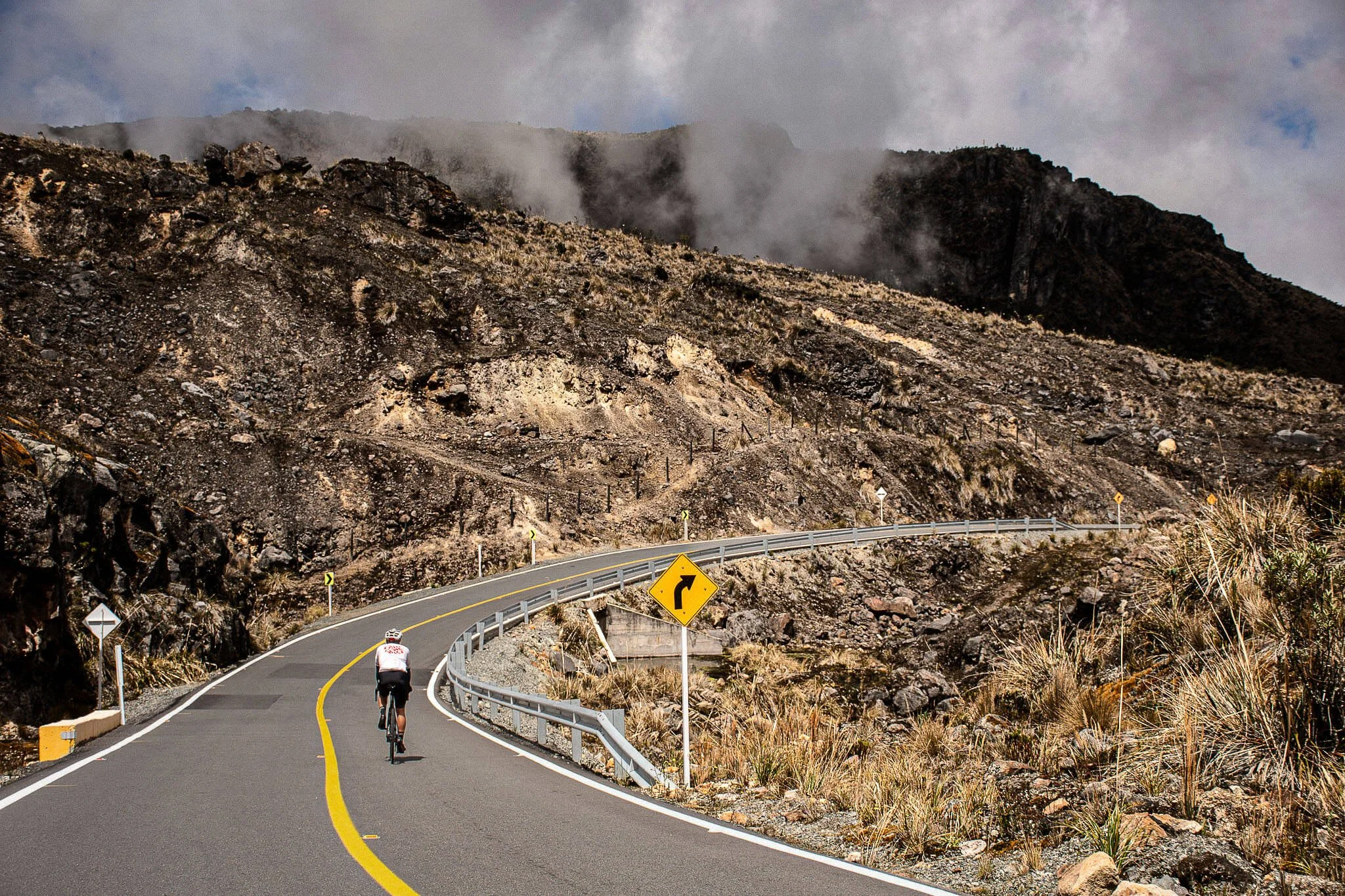
Líbano → Murillo → El Sifón → Letras
83 km (51 mi) | 3,300 m↑ (10,827 ft↑)
The queen stage. Ride through Murillo, Río Lagunilla, La Ventanas, El Sifón, and Kumanday before reaching Alto de Letras and its iconic sign.
The climb traverses Colombia’s most extreme climate zones, coffee hills, pine forests, Frailejones, and high-altitude páramo.

Reserve your spot
This climb is also fully customizable to match your level. Contact us to craft your journey!
Watch the short film
🎬
Watch the short film 🎬


Cycling journeys · Cycling tours Colombia · Small group travel · Expert-led travel · Immersive travel Colombia · Founder-led travel
Cycling journeys · Cycling tours Colombia · Small group travel · Expert-led travel · Immersive travel Colombia · Founder-led travel
Cycling journeys through the Colombian Andes · Coffee heartlands · Páramos · Caribbean Coast · High Altiplanos · Antioquia · Boyaca · Quindio · UNESCO-Listed · Cocora Valley · Alto El Sifón ·
→ → →
Cycling journeys through the Colombian Andes · Coffee heartlands · Páramos · Caribbean Coast · High Altiplanos · Antioquia · Boyaca · Quindio · UNESCO-Listed · Cocora Valley · Alto El Sifón · → → →